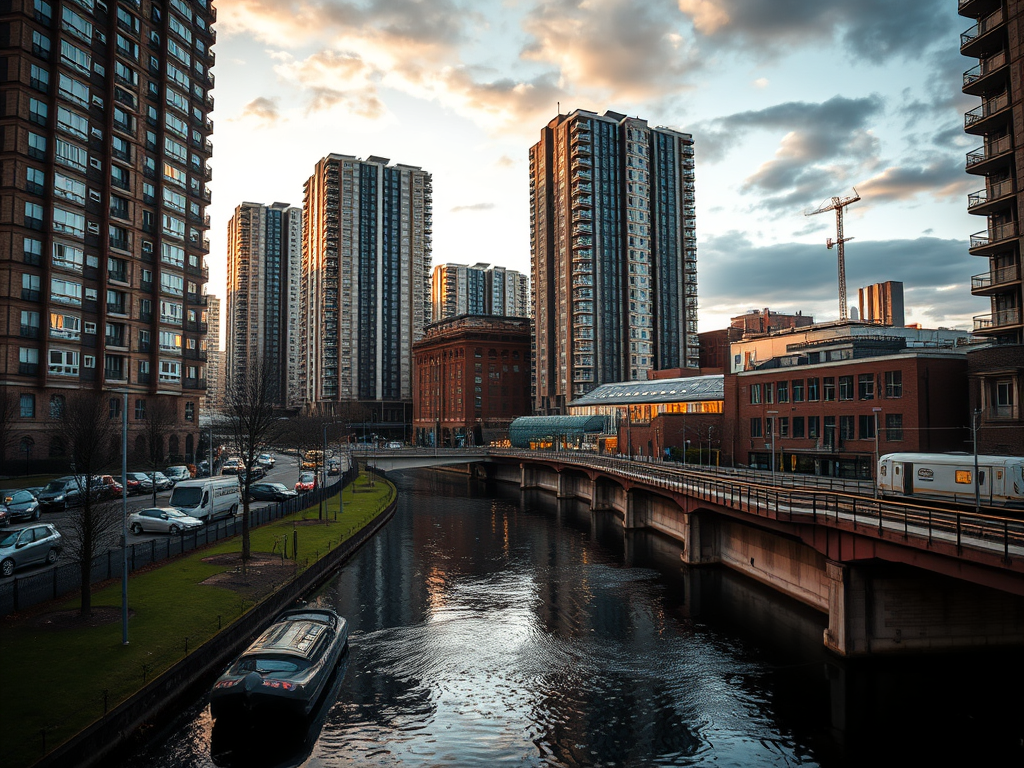
Newtown is a large inner-city district of Birmingham located immediately north of the city centre, bordered by Hockley, Aston, Nechells and the northern edge of the Jewellery Quarter. Today it is best known for its post-war housing estates and major road system, but its history reaches back to some of the most dramatic phases of Birmingham’s nineteenth- and twentieth-century growth.
Before the Second World War, Newtown was a dense area of terraced streets, factories and small workshops, similar to neighbouring Hockley and Aston. It formed part of Birmingham’s industrial heartland, with a population largely made up of skilled and semi-skilled workers employed in metal trades, engineering and manufacturing. Streets were tightly packed, housing was often overcrowded, and many properties had limited sanitation by modern standards, but the area supported a strong working-class community closely tied to nearby workplaces.
Much of old Newtown was destroyed during the Birmingham Blitz, when heavy bombing targeted the industrial districts north of the city centre. After the war, large areas were cleared as part of Birmingham’s ambitious slum clearance and redevelopment programme. Rather than rebuilding traditional streets, planners chose to create a modernist estate based on high-rise blocks, wide roads and open spaces, reflecting the urban planning ideas of the 1950s and 1960s.
The result was the Newtown Estate, one of the largest council housing developments in the city. Tall tower blocks and slab blocks replaced the old terraces, intended to provide healthier living conditions with better light, air and sanitation. Although the scheme was ambitious, it soon faced social and maintenance problems, and like many similar estates across Britain, it became associated with deprivation and isolation rather than the modern future its designers had imagined.
One of Newtown’s most significant landmarks is the Aston University campus, which occupies land on the southern edge of the district close to the city centre. The presence of the university has brought a steady population of students and academic activity into the area, creating a contrast with the surrounding residential estates. The nearby Birmingham and Fazeley Canal also runs through the district, providing one of the few physical links between the area’s industrial past and its present-day landscape.
Newtown is also shaped by major transport infrastructure. The A38(M) Aston Expressway and the city’s inner ring road cut through and around the area, making it highly accessible by car but also physically divided from neighbouring districts. These roads, built during the same post-war period as the housing estate, were designed to serve a growing motor city but contributed to Newtown’s sense of separation from the rest of Birmingham.
In recent years, Newtown has been the focus of long-term regeneration plans aimed at replacing outdated tower blocks with lower-rise housing, new streets and mixed-use development. Some of the original high-rise buildings have already been demolished, and new homes, parks and community facilities are gradually reshaping the area. The goal is to reintroduce a more traditional urban pattern and rebuild a stronger sense of neighbourhood identity.
Although often overlooked, Newtown occupies a key position between Birmingham’s historic industrial quarters and its modern city centre. Its story reflects the wider experience of post-war Birmingham, from industrial decline and bold redevelopment to the slow process of renewal and reinvention. Today, it remains one of the city’s most important areas of change, standing at the crossroads between its past and its future.





Leave a Reply